Summit
The peak
Aoraki/Mount Cook
See the parkChoose your stop
Open 29 stops
Start by picking a route; tap a pin or stop for its note and Google Maps.
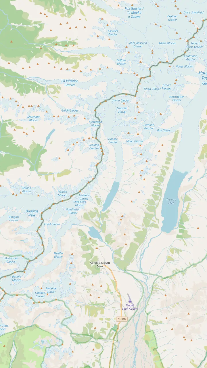
At 3,724 m, the highest peak in New Zealand, an ancestor sacred to Ngai Tahu.
Google MapsA 33-bunk alpine hut, the base for the guided route up the Linda Glacier.
Google MapsSeen from the Kea Point deck and the Hooker Valley lookouts.
Google MapsThe glacier at the head of the Hooker Valley, which feeds Hooker Lake.
Google MapsThe lake at the end of the Tasman Glacier, the largest and longest glacier in New Zealand.
Google MapsOne of the five big valley glaciers that shaped the park.
Google Maps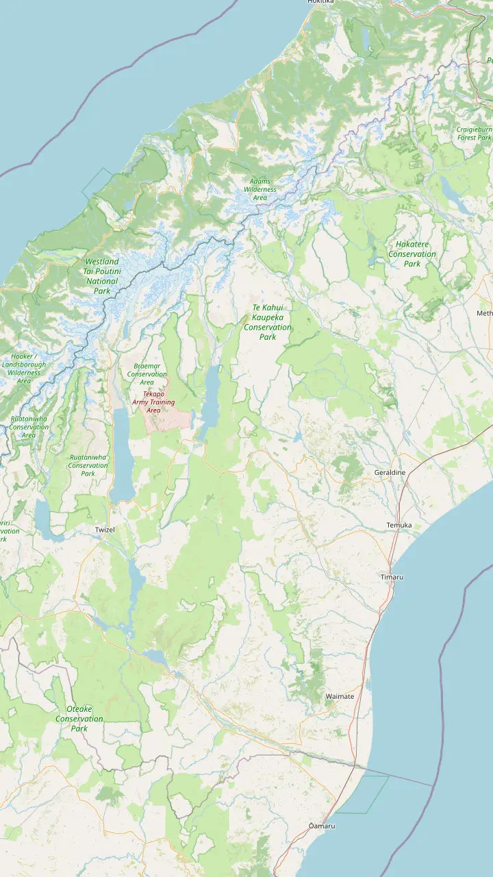
A coffee stop on the way south; the town is known for its food makers, such as a cheese factory in the town centre.
Google MapsCalled the Gateway to the Mackenzie Country, with a memorial to the sheep rustler who gave the region its name.
Google MapsA small township with a heritage walk and St Patrick's, the first pioneer church of the Mackenzie, from 1872.
Google MapsThe lakefront Church of the Good Shepherd was built from local stone in memory of the Mackenzie pioneers.
Google MapsA roadside lookout over Lake Pukaki on the road in; the Tekapo shuttle tour stops here for 10 minutes.
Google MapsThe Mt Cook Alpine Salmon shop stands here on SH8, near the lookout at the southern tip of Lake Pukaki.
Google MapsThe largest town of the Mackenzie, 45 minutes by car from Aoraki/Mount Cook.
Google MapsA high-country sheep station on Lake Pukaki, 15 minutes from the national park.
Google MapsThe village at the end of SH80, with a visitor centre, a day shelter, a fuel pump and a few places to eat.
Google Maps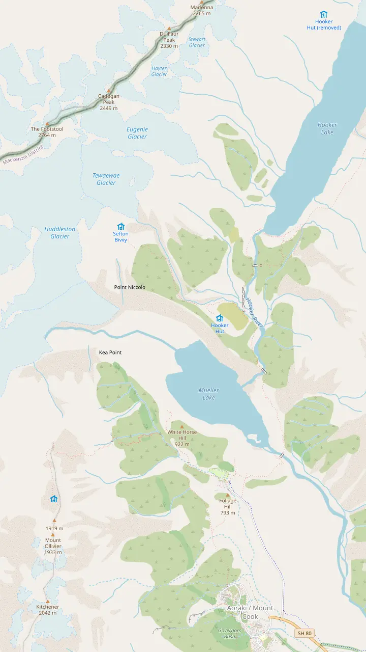
The Hooker Valley Track begins at White Horse Hill car park, where DOC charges for parking.
Google MapsA signposted side track near the start of the Hooker Valley walk, next to Freda's Rock.
Google MapsSwing bridges carry the track over the Hooker River, on gravel with some steps.
Google MapsFirst opened in 1910, the oldest hut in the park, with eight bunks.
Google MapsThe track ends at Hooker Lake, where icebergs float in summer below the mountain.
Google MapsA viewing deck on the Mueller Glacier moraine wall, 2 hours return from the village.
Google MapsAbout 2,200 steps climb to these small mountain lakes above the Hooker Valley.
Google MapsAn alpine serviced hut with 28 bunks, reached by a 4-hour advanced route.
Google MapsThe lake below the Mueller Glacier, seen from Kea Point and from the first part of the Hooker Valley Track.
Google Maps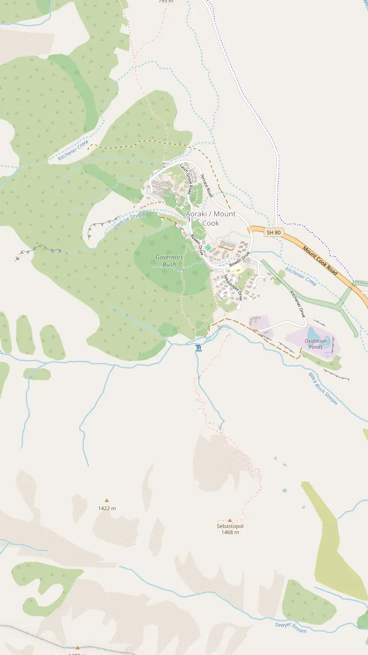
Free to enter and open daily from 8:30 am, with a large window that frames the mountain.
Google MapsThe hotel holds the Alpine Restaurant, the Panorama Room and the entrance to the Hillary Alpine Centre.
Google MapsA 30-minute walk from behind the Hermitage up to a lookout over the village.
Google MapsA 1.2 km loop through the trees to a lookout, sheltered on a poor-weather day.
Google MapsA steep, stepped climb of 300 m to small tarns coloured by red pond weed.
Google Maps© OpenStreetMap contributors, map data
Here are the Mount Cook facts worth knowing before you stand under it: how high it is and why that changed, what Aoraki means to Ngāi Tahu, how it came by its names, and what lives on its slopes.
Editorial team, mountcookdaytour.com · Updated November 8, 2026 · A 8 min read
The first of the Mount Cook facts is the simplest. Aoraki/Mount Cook is the highest mountain in New Zealand, and DOC gives its height as 3,724 m.1 NIWA describes the main divide of the Southern Alps reaching that height at its summit.7 DOC describes the park around it as rough country of rock and ice, where 19 summits pass 3,000 metres.8,6 Tourism New Zealand compares the park's area to Singapore.9
Where is Aoraki/Mount Cook located? In the central South Island, where State Highway 80 runs out after leaving State Highway 8 at Lake Pukaki.2,10 Allow 4.5 hours by road from Christchurch, says DOC, or 3.5 from Queenstown.2 The map here marks the road in, the walks of the Hooker Valley and the peaks above the village. InterCity notes that the park covers 70,696 hectares and was formally established as a national park in 1953.11
The park is part of a much larger protected landscape. DOC explains that it is part of Te Wāhipounamu, the South West New Zealand World Heritage Area, a listing that honours its natural values.12 In the widest sense the mountain is not just a summit, but the high heart of a chain of glaciers, valleys and lakes running down the length of the island. The village sits inside the park, at the foot of the mountain's southern ridges.
Quick reference
| Fact | Figure | Source |
|---|---|---|
| Height | 3,724 m1 | DOC |
| Peaks over 3,000 m | 196 | DOC |
| Park under glacier ice | 40%5 | DOC |
| Tasman Glacier length | 23 km28 | DOC |
| European name given | 18514 | DOC |
| First ascent | 189415 | DOC |
| Summit collapse | 1991, about 10 m16 | Alpine Guides |
| Park area | 70,696 hectares11 | InterCity |
Figures as each source states them; the park area is the bus operator's figure.11,1
For Ngāi Tahu, no ancestor is more sacred than Aoraki.3 DOC explains that the mountain is the ancestor made physical, joining the world of the spirit to the world of nature.19 The mountain has Tōpuni status, which DOC describes as a public symbol of Ngāi Tahu manawhenua and rangatiratanga.20 For the iwi the mountain is a living ancestor, not a scenic backdrop, and that is the spirit in which to visit.
DOC tells of Aoraki as a young boy aboard the canoe Te Waka a Aoraki, which ran aground on a reef and listed over.21 He and his brothers clambered onto the raised side of the wreck, where the icy southerly turned them to stone and made the mountain chain known as Kā Tiritiri o te Moana.13 Ngāi Tahu's own telling adds that Aoraki made an error in his karakia, after which the canoe dropped back into the sea and rolled onto its side.22
The brothers became the principal mountains of the Southern Alps, with Aoraki the highest.23 Ngāi Tahu explains that this is why it knows the South Island as Te Waka o Aoraki.24 The story belongs to the iwi, and the respectful way to carry it is as they tell it, without embroidery. Knowing it still changes how the skyline reads from the shore of Lake Pukaki on the drive in, with the highest peak standing above all the others.
Ask what is Mount Cook to a chart-maker and to Ngāi Tahu, and you get different answers. The European name came from the sea. In 1851 Captain Stokes, sailing down the West Coast, named the mountain after the navigator Captain James Cook.4 The modern name joins both histories. Ngāi Tahu records that the mountain was renamed Aoraki / Mount Cook, and that the new name flowed on to the village and the national park.17 Both names now appear together on road signs and maps, joined by a slash.
The renaming was part of a larger settlement. Ngāi Tahu explains that the Crown agreed to include the return of Aoraki to the tribe in its Settlement Offer.36 Once the title passed to Ngāi Tahu, the tribe would gift Aoraki to the nation, as a lasting sign of its commitment to managing places of historic, cultural and conservation value together with the Crown.18 The gift turned a legal title into a statement about how the mountain should be looked after.
Alongside the gift, the settlement handed Ngāi Tahu several formal tools: a Statutory Acknowledgement, a Deed of Recognition, Tōpuni status and the position of Statutory Adviser.37 Those tools give the iwi a voice in how the mountain is cared for. They also explain the requests visitors meet in the park: DOC notes that Ngāi Tahu cannot accept waste left in the park, as the streams from Aoraki are sacred to them.38 Take that as the house rule of a sacred place.
See it for yourself
Pick the part of the mountain that interests you most and go there.
If I want the Ngāi Tahu story
The DOC visitor centre
It holds artwork and exhibits about the area.31
If I want the climbing history
The Hillary Alpine Centre
Its museum covers climbing and Sir Edmund Hillary.32
If I want to see the peak up close
The Hooker Valley Track
It ends at Hooker Lake below Aoraki.33
If I want glacier ice
Hooker Lake in summer
Icebergs float on the lake in summer.34
If I want the Mount Cook lily
Visit from December to March
That is when the alpine flowers bloom.35
Sides of the mountain
Summit
Aoraki/Mount Cook
See the park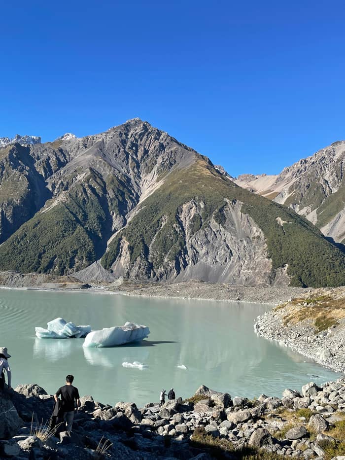
Ice
The valley systems
See the park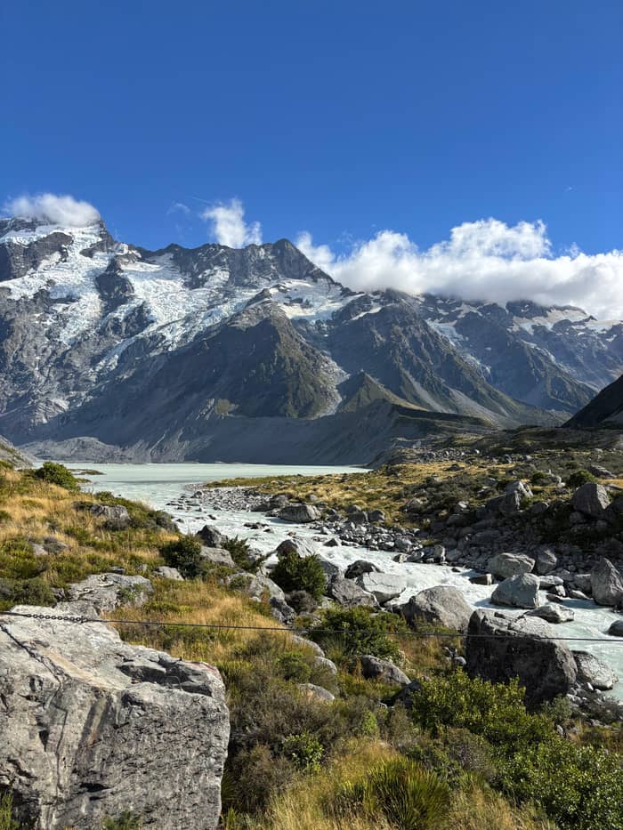
Nature
Plants and birds
See the parkAoraki is a mountain that is still changing. Alpine Guides, which has led climbs in the park since 1966, records that on December 14, 1991 the High Peak collapsed, dropping about 10 vertical metres of summit, millions of tonnes of rock and ice, onto the East Face.87,16 What remains is an exposed and unstable ice ridge.88 DOC quotes the height today as 3,724 m.1 Older books and posters may still show a taller figure.
Rockfall is not only history. DOC notes that a large rock avalanche came off Mt Haast in 2013, and that several other large landslides have followed in the central Southern Alps.89 DOC warns that an avalanche is possible here whatever the season, and rates most of the park as complex avalanche terrain.86,90 For climbers this shapes every route; for day visitors it explains the warning signs at the end of the valley tracks.
The valley floor tells the same story more slowly. The Kea Point track crosses ground shaped in 1913, when meltwater burst from the glacier towards the first Hermitage.91 Hooker Hut, the oldest hut in the park, first opened in 1910 on the moraine wall beside the Hooker Glacier.79,80 DOC records that it was moved uphill again in 1961 and 1994 as that wall kept cracking, a reminder that nothing here stands still.92
See Aoraki in a day
Enter your party size and compare what each day starts from.
3 options compared
Enter your party size and compare what each day starts from.
≈
View≈
View≈
ViewFigures are GetYourGuide from-prices, translated at the ECB reference rate. The booking step shows what you pay exactly.
The mountain's story
Origins
A freezing southerly turned the brothers to stone.13
Naming
Captain Stokes named it in 1851.4
First try
First ascent
Fyfe, Clarke and Graham summited in 1894.15
Collapse
About 10 vertical metres fell in 1991.16
Settlement
Glaciers cover 40% of the park, according to DOC.5 Five major valley systems carry them: the Godley, Murchison, Tasman, Hooker and Mueller.25 The Tasman Glacier is New Zealand's largest and longest; DOC measures it at 23 km in length and up to three km across, covering 101 sq km.67,28 It is clearly visible from the highway at the park entrance, without any walk at all.67 Watch for it as the road nears the village.
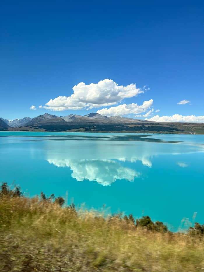
The glaciers reach far beyond their ice. Lake Pukaki takes its turquoise colour from glacial flour, rock ground so fine that it hangs in the water.93 The lake is fed by the braided Tasman River, which rises in the Hooker and Tasman glaciers.94 The Pukaki Boulders beside the highway are glacial erratics that the Tasman Glacier dropped over 10,000 years ago.95 The whole drive in is a lesson in what moving ice leaves behind.
Closer to the village, Hooker Lake at the end of the most famous walk collects icebergs in summer.34 DOC asks visitors not to climb them, as they are unstable and can tip without warning.85 The lakes are typically about 3 degrees, cold enough to cause hypothermia quickly.29 Look, photograph and stay on the shore; that is the safe way to meet the ice on foot. The colours of the floating ice change with the light through the day.
Video
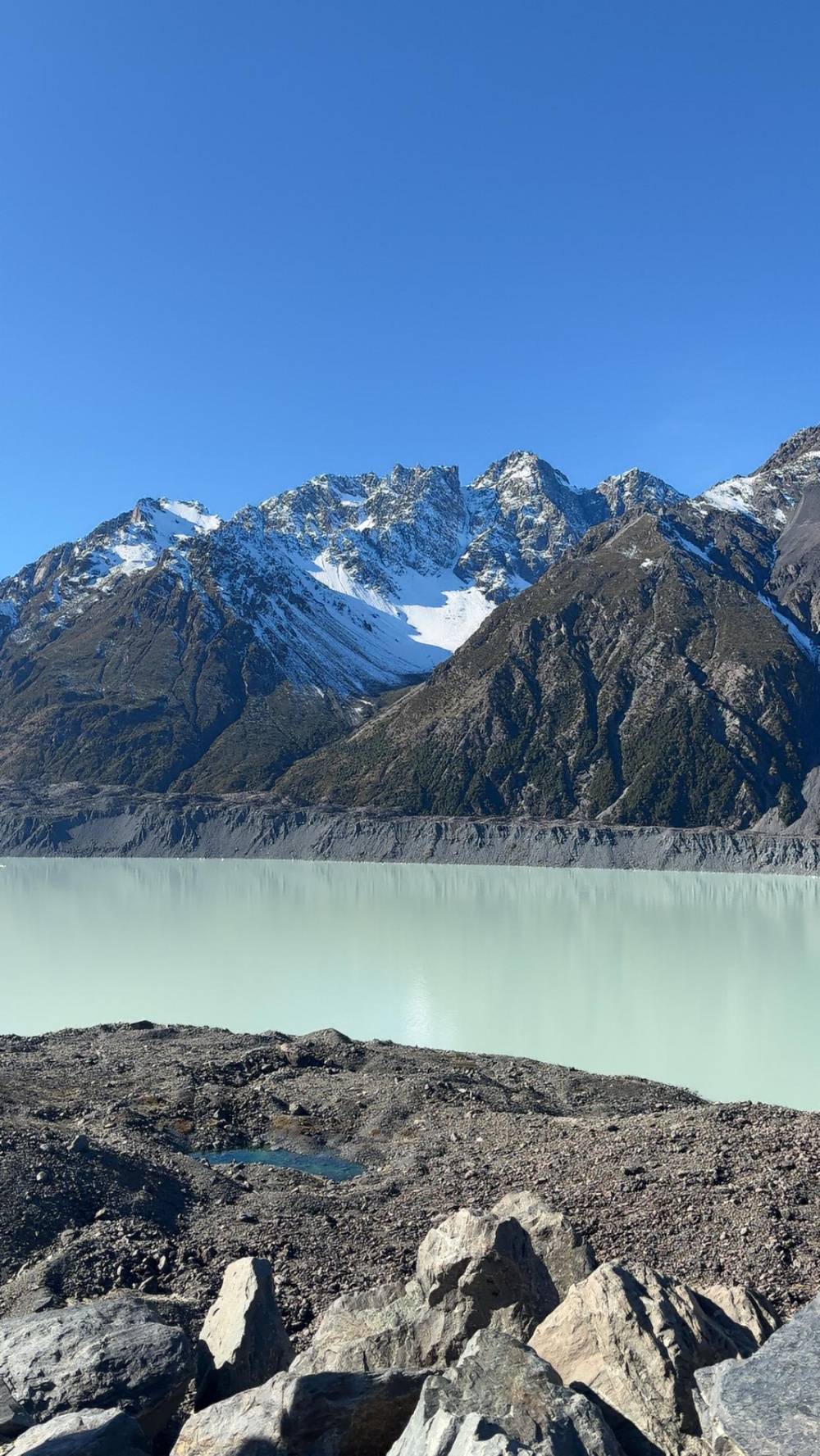
TRACKS - Travel Documentaries on YouTube · Playback files load only once you tap play.
The ancestor embodied in the mountain remains the physical manifestation of Aoraki, the link between the supernatural and the natural world
Visiting a sacred place
DOC notes that there is virtually no forest in the park; instead it is full of alpine plants, with over 300 species recorded.96,27 The star is the Mount Cook lily, which is not a lily at all but the largest buttercup in the world.97 Tourism New Zealand times the alpine flowers from December to March, with the lily alongside daisies, gentians and edelweiss.35 Walk the valley tracks in those months to see them in flower.
About 40 species of birds live in the park, and the most distinctive may be the kea, a mountain parrot known for mischief.26 The tiny rock wren, piwauwau, is the single true alpine bird, and it sits out the winter among high rock basins.98 The braided bed of the Tasman River shelters the kakī, or black stilt, one of New Zealand's rarest birds.30 Watch all of them from a distance and leave them to their business.
The smallest residents are among the strangest. DOC describes a black wētā that lives above the snowline and goes by the nickname of the Mount Cook flea.99 Rules protect all of it. No dogs or other animals may enter the park, fires are banned, and recreational drones are not allowed anywhere inside it.83,82,84 The park is a home first and a sight second, and the rules follow from that. Visitors who keep to them help that balance hold.
Why is Mount Cook so famous? Height alone would make it a landmark, but its fame comes as much from the people who tried to climb it. DOC records the first attempt in 1882 by the Irish Reverend Green and two Swiss guides, whose party came within 20 metres of the top.14,15 Success came in 1894, when the New Zealanders Tom Fyfe, George Graham and Jack Clarke stood on top.15 DOC now ranks the park with the great climbing grounds of the world.100
The village carries that history. Old Mountaineers, beside the visitor centre, has a claim no other business in the village shares: Sir Edmund Hillary officially opened it.101 The Sir Edmund Hillary Alpine Centre at the Hermitage tells the story of the region, its climbers and Hillary himself.32 For anyone who grew up on stories of mountains, this is a place where the names on the old photographs stood.
The rest of the fame comes from access. A sealed road runs right to the village, and a day walk leads to the foot of the peak. DOC puts the Hooker Valley in the top tier of New Zealand day walks.102 Add the turquoise lakes, the glaciers and the sacred story of Aoraki, and what Mount Cook is famous for becomes clear: a mountain that is both a climber's test and a place anyone can stand beneath.
FAQ
DOC gives Aoraki/Mount Cook as 3,724 m, New Zealand's highest peak.1
It stands at the end of State Highway 80, 3.5 hours by road from Queenstown.2
He named it after the navigator Captain James Cook.4
Alpine Guides records a collapse of about 10 vertical metres from the High Peak.16
Success went to three New Zealanders, Fyfe, Graham and Clarke.15
DOC calls it the largest buttercup in the world.97
Sources
Further reading
Planning a day out to Aoraki? A real person replies here.