Dynamic chart
Mount Cook conditions through the year and what they mean for you
Light and cold by month
Sun and temperature through the year
Choose a month to see the hours of sun at Mount Cook and the average high and low at the nearest long record.
Sunset
Jan
The January average high at Tara Hills is 23.1 °C.5
Jun
Mid-June has 8.9 hours of sun above the horizon.5
Jul
The July average low at Tara Hills is -3.3 °C.5
Dec
Mid-December has 15.4 hours of sun above the horizon.5
Sunset is worked out for the 15th of each month on New Zealand time. Day length is for Aoraki/Mount Cook Village; temperatures come from the NOAA station at Tara Hills near Omarama, 88 km away, 1991 to 2020.
Mount Cook conditions swing fast. The village sits under the wet main divide, a short drive from a dry, sunny basin. Here is what the records say, month by month.
Editorial team, mountcookdaytour.com · Updated November 8, 2026 · A 8 min read
The essentials
- Wet at the villageMt Cook Village averages 153 wet days a year, against 72 at Tara Hills.1
- Big rainfallThe village normal is 4,285 mm a year, Lake Tekapo 591 mm.2
- Fast changesStrong wind, rain and snow can arrive at any time of year.3
- Winter roadSnow can limit access from June to September.4
- Long daysMid-December has 15.4 hrs of sun above the horizon.5
Wet mountains, dry basin, same road
Mount Cook conditions are a lesson in how much a mountain range can do to the weather. NIWA explains that westerly airflows bring rain and cloud along the main divide of the Southern Alps, while country farther east gets less rain and more sunshine.6 The village sits right under the main divide. Lake Tekapo, 1 hour 15 minutes away by road, sits out in the basin.7 The two places can feel like different countries on the same morning.
Mackenzie tourism describes its basin as semi-arid, because the mountains keep most of the rain away.8 NIWA notes that Lake Tekapo often ranks in the top-5 places in New Zealand for yearly sunshine.9 It also notes that high mountain country is the exception, where extra cloud cuts the sunshine.10 A blue sky over Tekapo is no promise for the head of the Hooker Valley, and a cloudy basin can still hide a clear peak.
That split is the key to reading any forecast for the day. Check the national park, not the region. DOC links to MetService's forecasts and observations for the park, and points walkers to NIWA's park forecast on its track pages.11,12 A regional forecast blends the wet mountains with the dry basin, and only a mountain forecast tells you what the walk and the view will be like. Read it the evening before and again at breakfast.
Month by month
Rain at the village and temperatures in the basin
| Month | Rain at the village | Wet days | Tara Hills high / low |
|---|---|---|---|
| January | 423 mm18 | 1219 | 23.1 / 9.4 °C5 |
| February | 260 mm18 | 1019 | 23.6 / 8.8 °C5 |
| March | 380 mm18 | 1219 | 20.1 / 5.7 °C5 |
| April | 344 mm18 | 1319 | 15.6 / 2.8 °C5 |
| May | 365 mm18 | 1319 | 12.1 / 0.7 °C5 |
| June | 322 mm18 | 1219 | 8.5 / -1.6 °C5 |
| July | 265 mm18 | 1219 | 7 / -3.3 °C5 |
| August | 301 mm18 | 1319 | 9.7 / -1 °C5 |
| September | 345 mm18 | 1319 | 13.1 / 1.4 °C5 |
| October | 416 mm18 | 1519 | 16.1 / 3.6 °C5 |
| November | 367 mm18 | 1419 | 17.9 / 5.2 °C5 |
| December | 497 mm18 | 1419 | 21.1 / 7.7 °C5 |
NIWA normals for Mt Cook Village give the rain and the wet days; temperatures are NOAA averages for Tara Hills near Omarama, 88 km away in the basin.18,5
Rain and wet days at the village, month by month
NIWA's 1981 to 2010 normals put the yearly rainfall at Mt Cook Village at 4285 mm.18 For comparison, the same table gives Lake Tekapo 591 mm and Tara Hills near Omarama 506 mm, and Christchurch 618 mm.2 In other words, the village gets several times the rain of the basin you drive through to reach it. Pack for it whatever the sky looks like at breakfast. A light rain shell weighs little and saves the day.
There is no dry season. The wettest normals are December with 497 mm, January with 423 mm and October with 416 mm; the lowest are February with 260 mm and July with 265 mm.18 Wet days, those with at least 1 mm, run from 10 in February to 15 in October, and the year totals 153.19 Rain gear is not optional in any month of the year here. Keep a dry layer in a sealed bag inside your daypack.
Those numbers sound grim, but they hide how quickly the weather moves. DOC describes very fast changes in the region's weather.20 A wet morning can clear by lunch, and a bright start can close in within an hour. Flexible plans work best here: keep a short walk and an indoor stop in reserve, and go for the long walk when the cloud lifts rather than at the time you planned. Patience is part of the trip.
Temperatures: the nearest long record and the village extremes
The nearest station with a long temperature record is Tara Hills near Omarama, 88 km from the village, out in the basin.5 Its January average runs from a high of 23.1 °C to a low of 9.4 °C.5 July averages run from 7 °C by day down to -3.3 °C at night.5 Treat those basin figures as a guide only: the village sits among the mountains, close to the ice and under the main divide. Mornings and evenings there can feel sharply colder than the basin.
NIWA's records for Mount Cook Village itself give a highest recorded temperature of 32.8 °C and a lowest of -13.9 °C, with 98 days a year when the minimum falls below 0 °C.29 Mackenzie tourism describes summer from November to February, when the basin often passes 30 degrees, and winter from June to September, with nights below 0 degrees and sunny days of about 8 degrees.13,30 Spring and autumn sit between those extremes and can swing from one to the other in a day.
In practice, layers are the answer. Mackenzie tourism recommends layering and wool, a waterproof jacket, gloves and hats for the cooler months, and light clothing, a hat and sunscreen in summer.31,32,33 Bring the warm layer in January too. A walk to Hooker Lake starts in the valley and ends beside water that DOC puts at about 3 degrees, with wind coming straight off the ice.34 A hat and gloves earn their space even in summer.
Read the forecast
What to do with the weather you get
Match the plan to the sky over the park, not over the city you leave from.
If The park forecast is clear
Go long: the Hooker Valley
If Strong wind is forecast
Take a sheltered loop
DOC closes the Hooker Valley in strong winds; Governors Bush is sheltered.25,26
If It is raining at the village
Head indoors first
Its exhibits and films can fill half a day.27
If Snow is on the road
Check SH80 before leaving
Snow can close SH80.28
If Cloud hides the peak
Wait it out on a short walk
Weather here changes very fast.20
Wind, the north-west and the days tracks close
Wind is the part of the weather to respect most here. NIWA describes the high country near the main divide as a place of prevailing north-west winds, heavy precipitation, winter snow and glaciers.38 At Mt Cook Village it records gusts over 61 km/hr on 108 days a year on average, and over 94 km/hr on 15 days.39 The highest gust on its record there is 177.8 km/hr, on 21 February 2004.40
Average wind speeds are highest from spring into summer. NIWA's monthly means for the village peak at 12.4 km/hr in January and 11.9 km/hr in November, and drop to 6.8 km/hr in July.22 Thunder is heard there on nine days a year on average.41 On the Sealy Tarns climb, DOC warns that bad weather generally arrives from the north-west, and that walkers should turn back when they see it coming.36
Wind is also what closes the most popular walk. In strong winds or heavy rain DOC shuts the Hooker Valley Track and puts up signs and a gate.25 When that happens, the sheltered Governors Bush loop is the fallback, since DOC describes it as a sheltered place to be outdoors in poor weather.26 The visitor centre is the other, with enough inside, by DOC's account, to fill half a day.27 Neither needs a clear sky.
The year at the mountain
Seasons at Aoraki, as the sources describe them
Summer
Warm, long and busy
Basin temperatures often pass 30 degrees; the track is busiest from December.13,14
Late summer
Flowers in bloom
Alpine flowers, the Mount Cook lily among them, flower until March.15
Autumn
Colour and calmer air
Mackenzie tourism calls autumn a riot of colour.16
Winter
Snow and short days
Access may be limited from June to September.4
Spring
Wild flowers and wind
Spring brings wild flowers; the walking season opens in October.16,17
Snow, ice and the road in winter
Winter brings the clearest air and the hardest travel. DOC says access may be limited from June to September because of snowfall, and that snow can close SH80.4,28 Mackenzie tourism adds that in winter snow and ice can cover the region's roads.42 If you are driving yourself, check the official road status on the morning, and plan an extra night in case the road stays shut. Snow chains are worth asking about when you hire the car.
On foot, winter changes the tracks. DOC warns that the Hooker Valley Track can become very icy and extremely slippery in shaded areas, and recommends microspikes and hiking poles.43,21 Sealy Tarns may need an ice axe and crampons, with avalanche risk.44 DOC also stresses that avalanches can occur in the park in any season, and points to the New Zealand Avalanche Advisory for daily assessments.45,46
Winter days are short, and the village works shorter hours too. From May to September the DOC visitor centre shuts at 4:30 pm instead of 5 pm, opening at 8:30 am in both seasons.47,48 Our listing runs in all weather, and it asks guests to dress for the conditions. On a snowy day that means boots with grip, gloves and a hat, not trainers and a light jacket. Sunglasses matter too, as snow throws the light back at you.
Video
Aoraki/Mount Cook on a winter road trip
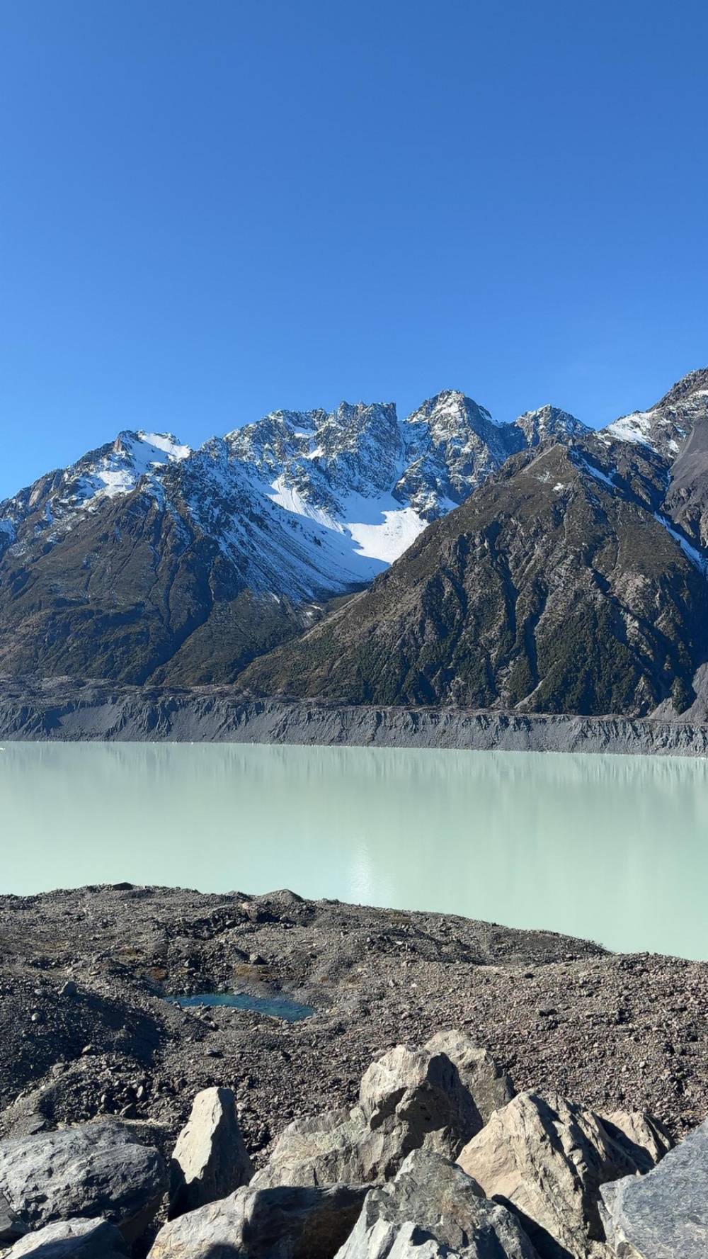
Scott Howes on YouTube · Playback files load only once you tap play.
it's common to experience strong wind, high rainfall, heavy snowfall and rapid changes in temperature at any time of the year
Pack for the conditions
A weather checklist for the park
Every season3
Cold months3
Daylight, golden light and the best months
Daylight swings hard with the seasons this far south. Mid-December brings 15.4 hrs of sun above the horizon, mid-June just 8.9 hrs.5,5 Long summer evenings give a day visitor time for a walk after the tour crowds leave. Short winter days compress everything, and a coach day that starts and ends in the dark still has only a few hours of light at the mountain. Plan the walk for the brightest part of the day.
The low sun is when the peaks glow. DOC picks the Glencoe Walk lookout at sunrise or sunset for the glow on the peaks, and calls Red Tarns a magnificent spot for a summer sunset.49,50 Those are moments for travellers who stay overnight. A day tour arrives around midday, when the light is flat, and a clear sky matters more than the hour. Sunrise and sunset belong to those who sleep at the mountain.
For walking, Tourism New Zealand favours the months from October to April, with alpine flowers from December to March, including the Mount Cook lily.17,15 It also flags December to February as the busiest months on the valley track.14 Mackenzie tourism calls autumn a riot of colour and says spring brings wild flowers across the region.16 There is no wrong month, only different kit and a different list of walks.
When the cloud stays down on tour day
Cloud is the real risk of a day trip. Our listing runs in all weather, and the bus goes even when the mountain hides. Plan for that before you book. If your dates are flexible, keep the tour for a day when the park forecast looks settled, and keep the listing's free cancellation window in mind as your safety valve. A clear forecast for Christchurch says nothing about the Hooker Valley.
If the cloud stays down when you arrive, change the plan rather than waiting. The lakes on the way in are lower and often brighter, and Lake Pukaki can show colour under a thin cloud. At the village, the visitor centre has a large window facing the mountain, artwork, exhibits and films.51,27 The Sir Edmund Hillary Alpine Centre has a museum and a theatre with a planetarium.52,53 Both are a short walk apart in the village.
Clouds also lift. Mountain weather changes fast, and DOC describes rapid changes at any time of year.3 Keep checking the sky from the valley floor during your free time, and be ready to walk the moment it opens. A short walk to the Kea Point deck or along the first part of the Hooker Valley can still give a view that a full day of sunshine would envy, simply because you saw the peak appear.
FAQ
Straight answers to common questions.
How wet is Mount Cook Village?
What is the best month to visit Mount Cook?
Tourism New Zealand recommends October to April for the park's walking tracks.17
Is the road to Mount Cook open in winter?
How cold is it at Mount Cook in winter?
Does the tour run if it rains?
Our listing runs in all weather and asks guests to dress for it.
When does the Hooker Valley Track close?
DOC closes the track in those conditions, with signs and a gate.25
Sources
- NIWA (National Institute of Water and Atmospheric Research) · The climate and weather of Canterbury, 2nd edition (NIWA Science and Technology Series 68, 2016) ↩
- NIWA (National Institute of Water and Atmospheric Research) · The climate and weather of Canterbury, 2nd edition (NIWA Science and Technology Series 68, 2016) ↩
- Department of Conservation (DOC) · Hooker Valley Track ↩
- Department of Conservation (DOC) · Aoraki/Mount Cook National Park ↩
- NOAA · Global Summary of the Month, Station Tara Hills (NOAA GHCN NZ000937470), 1991 to 2020 ↩
- NIWA (National Institute of Water and Atmospheric Research) · The climate and weather of Canterbury, 2nd edition (NIWA Science and Technology Series 68, 2016) ↩
- Mackenzie Region (Mackenzie District tourism) · Getting here and around ↩
- Mackenzie Region (Mackenzie District tourism) · Seasons and climate ↩
- NIWA (National Institute of Water and Atmospheric Research) · The climate and weather of Canterbury, 2nd edition (NIWA Science and Technology Series 68, 2016) ↩
- NIWA (National Institute of Water and Atmospheric Research) · The climate and weather of Canterbury, 2nd edition (NIWA Science and Technology Series 68, 2016) ↩
- Department of Conservation (DOC) · Aoraki/Mount Cook National Park ↩
- Department of Conservation (DOC) · Hooker Valley Track ↩
- Mackenzie Region (Mackenzie District tourism) · Seasons and climate ↩
- Tourism New Zealand · Things to see and do in Aoraki / Mount Cook ↩
- Tourism New Zealand · Things to see and do in Aoraki / Mount Cook ↩
- Mackenzie Region (Mackenzie District tourism) · Seasons and climate ↩
- Tourism New Zealand · Things to see and do in Aoraki / Mount Cook ↩
- NIWA (National Institute of Water and Atmospheric Research) · The climate and weather of Canterbury, 2nd edition (NIWA Science and Technology Series 68, 2016) ↩
- NIWA (National Institute of Water and Atmospheric Research) · The climate and weather of Canterbury, 2nd edition (NIWA Science and Technology Series 68, 2016) ↩
- Department of Conservation (DOC) · Hooker Valley Track ↩
- Department of Conservation (DOC) · Hooker Valley Track ↩
- NIWA (National Institute of Water and Atmospheric Research) · The climate and weather of Canterbury, 2nd edition (NIWA Science and Technology Series 68, 2016) ↩
- Department of Conservation (DOC) · Hooker Valley Track ↩
- Department of Conservation (DOC) · Hooker Valley Track ↩
- Department of Conservation (DOC) · Hooker Hut ↩
- Department of Conservation (DOC) · Governors Bush Walk ↩
- Department of Conservation (DOC) · Aoraki/Mount Cook National Park Visitor Centre ↩
- Department of Conservation (DOC) · Hooker Valley Track ↩
- NIWA (National Institute of Water and Atmospheric Research) · The climate and weather of Canterbury, 2nd edition (NIWA Science and Technology Series 68, 2016) ↩
- Mackenzie Region (Mackenzie District tourism) · Seasons and climate ↩
- Mackenzie Region (Mackenzie District tourism) · Seasons and climate ↩
- Mackenzie Region (Mackenzie District tourism) · Seasons and climate ↩
- Mackenzie Region (Mackenzie District tourism) · Seasons and climate ↩
- Department of Conservation (DOC) · Hooker Valley Track ↩
- Department of Conservation (DOC) · Aoraki/Mount Cook National Park ↩
- Department of Conservation (DOC) · Sealy Tarns Track ↩
- Department of Conservation (DOC) · Aoraki/Mount Cook National Park ↩
- NIWA (National Institute of Water and Atmospheric Research) · The climate and weather of Canterbury, 2nd edition (NIWA Science and Technology Series 68, 2016) ↩
- NIWA (National Institute of Water and Atmospheric Research) · The climate and weather of Canterbury, 2nd edition (NIWA Science and Technology Series 68, 2016) ↩
- NIWA (National Institute of Water and Atmospheric Research) · The climate and weather of Canterbury, 2nd edition (NIWA Science and Technology Series 68, 2016) ↩
- NIWA (National Institute of Water and Atmospheric Research) · The climate and weather of Canterbury, 2nd edition (NIWA Science and Technology Series 68, 2016) ↩
- Mackenzie Region NZ (mackenzienz.com, regional tourism organisation) · Getting Here & Around ↩
- Department of Conservation (DOC) · Hooker Valley Track ↩
- Department of Conservation (DOC) · Sealy Tarns Track ↩
- Department of Conservation (DOC) · Aoraki/Mount Cook National Park ↩
- Department of Conservation (DOC) · Be avalanche alert in Aoraki/Mount Cook National Park ↩
- Department of Conservation (DOC) · Aoraki/Mount Cook National Park Visitor Centre ↩
- Department of Conservation (DOC) · Aoraki/Mount Cook National Park Visitor Centre ↩
- Department of Conservation (DOC) · Glencoe Walk ↩
- Department of Conservation (DOC) · Red Tarns Track ↩
- Department of Conservation (DOC) · Aoraki/Mount Cook National Park Visitor Centre ↩
- Mackenzie Region (Mackenzie District tourism) · Sir Edmund Hillary Alpine Centre ↩
- Mackenzie Region (Mackenzie District tourism) · Sir Edmund Hillary Alpine Centre ↩
Further reading