Flexible
Drive yourself
State Highway 80
- From Christchurch4.5 hours
- From Queenstown3.5 hours
- ParkingFees at White Horse Hill
Choose your stop
Short answer
To get to Mount Cook National Park, follow State Highway 80 to its end, about 4.5 hours from Christchurch or 3.5 hours from Queenstown by car, or take the InterCity bus from Lake Tekapo.
Route essentials
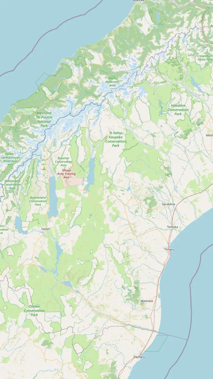
Open 29 stops
Start by picking a route; tap a pin or stop for its note and Google Maps.
A coffee stop on the way south; the town is known for its food makers, such as a cheese factory in the town centre.
Google MapsCalled the Gateway to the Mackenzie Country, with a memorial to the sheep rustler who gave the region its name.
Google MapsA small township with a heritage walk and St Patrick's, the first pioneer church of the Mackenzie, from 1872.
Google MapsThe lakefront Church of the Good Shepherd was built from local stone in memory of the Mackenzie pioneers.
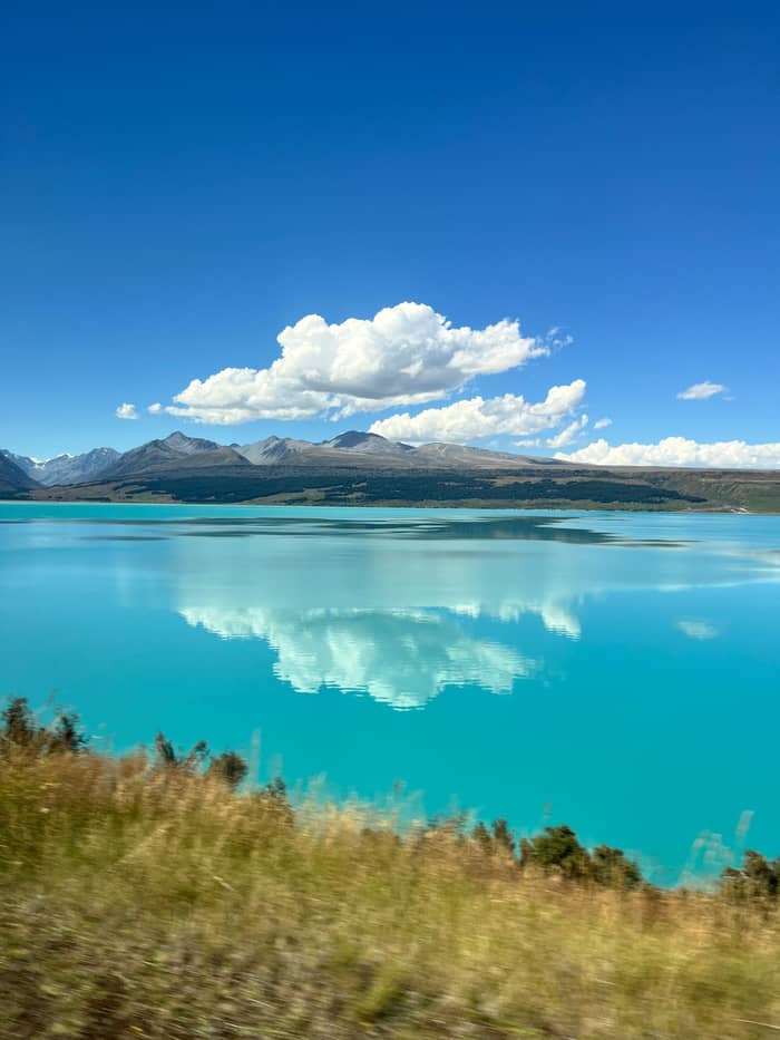
Google MapsA roadside lookout over Lake Pukaki on the road in; the Tekapo shuttle tour stops here for 10 minutes.
Google MapsThe Mt Cook Alpine Salmon shop stands here on SH8, near the lookout at the southern tip of Lake Pukaki.
Google MapsThe largest town of the Mackenzie, 45 minutes by car from Aoraki/Mount Cook.
Google MapsA high-country sheep station on Lake Pukaki, 15 minutes from the national park.
Google MapsThe village at the end of SH80, with a visitor centre, a day shelter, a fuel pump and a few places to eat.
Google Maps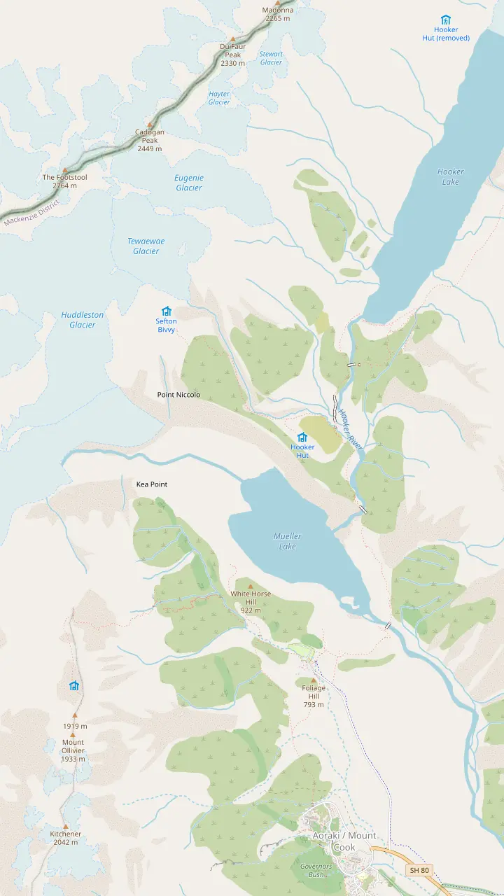
The Hooker Valley Track begins at White Horse Hill car park, where DOC charges for parking.
Google MapsA signposted side track near the start of the Hooker Valley walk, next to Freda's Rock.
Google MapsSwing bridges carry the track over the Hooker River, on gravel with some steps.
Google MapsFirst opened in 1910, the oldest hut in the park, with eight bunks.
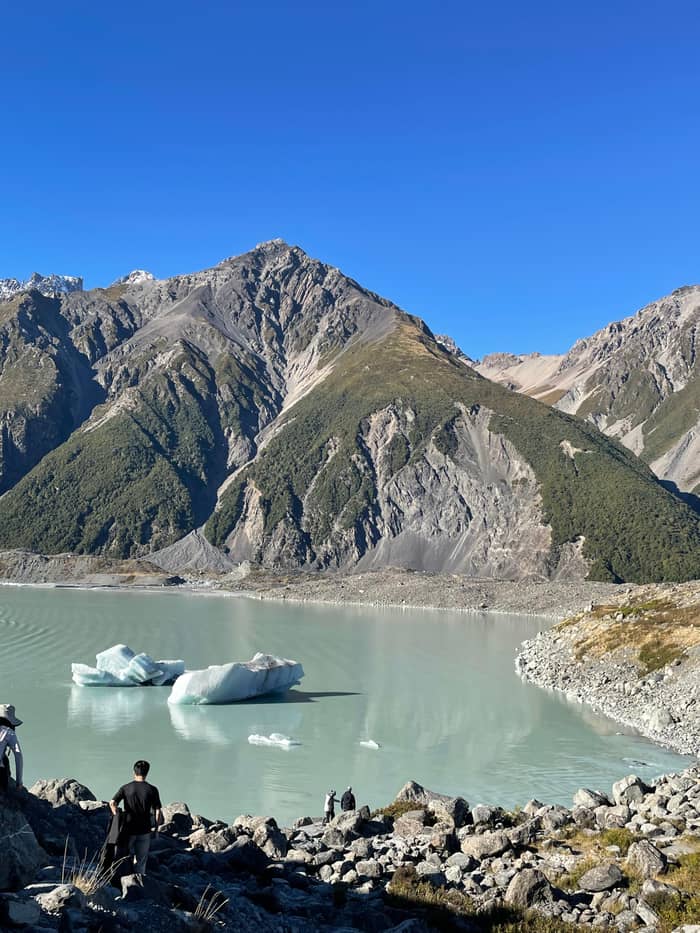
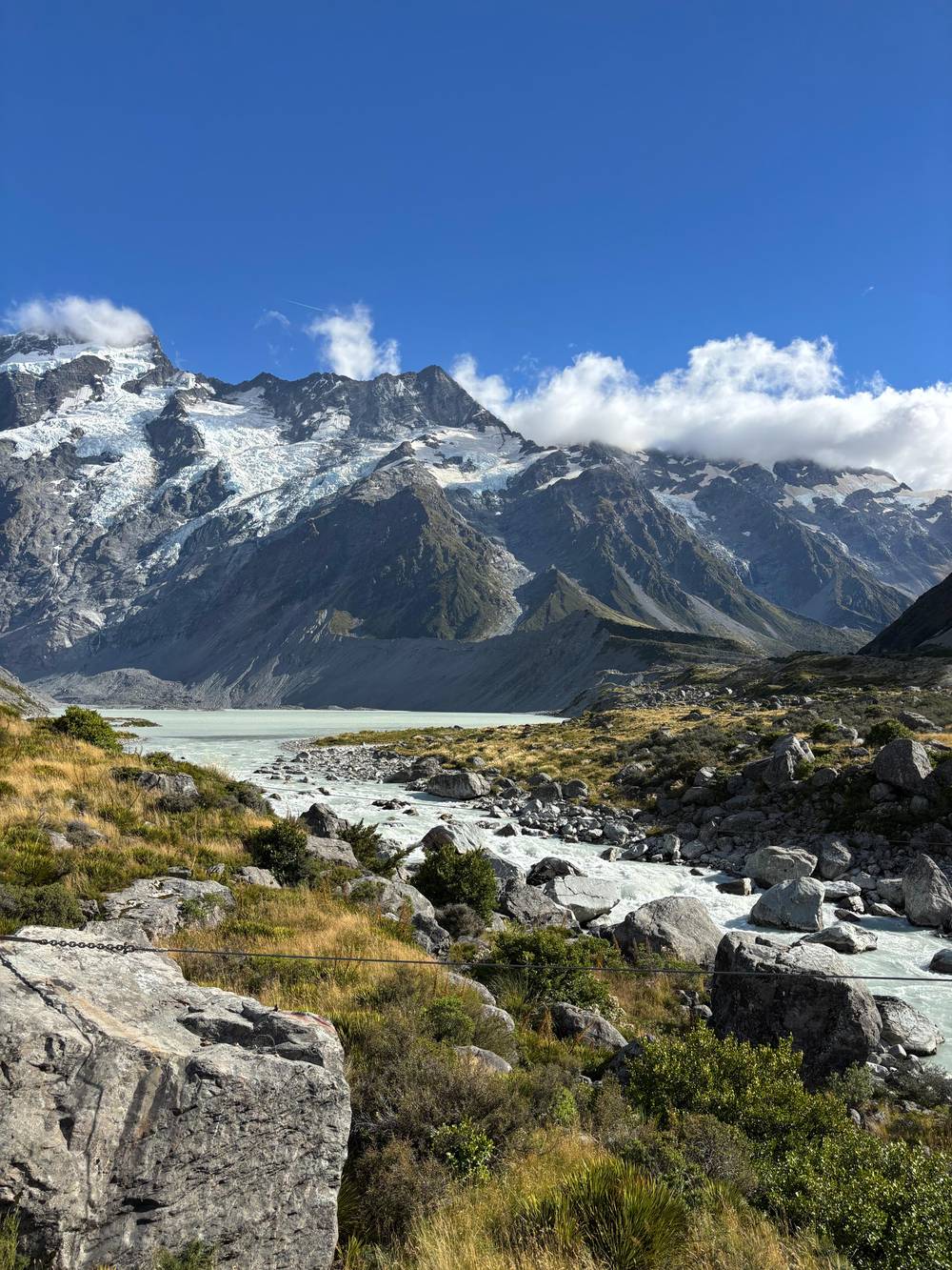
Google MapsThe track ends at Hooker Lake, where icebergs float in summer below the mountain.
Google MapsA viewing deck on the Mueller Glacier moraine wall, 2 hours return from the village.
Google MapsAbout 2,200 steps climb to these small mountain lakes above the Hooker Valley.
Google MapsAn alpine serviced hut with 28 bunks, reached by a 4-hour advanced route.
Google MapsThe lake below the Mueller Glacier, seen from Kea Point and from the first part of the Hooker Valley Track.
Google Maps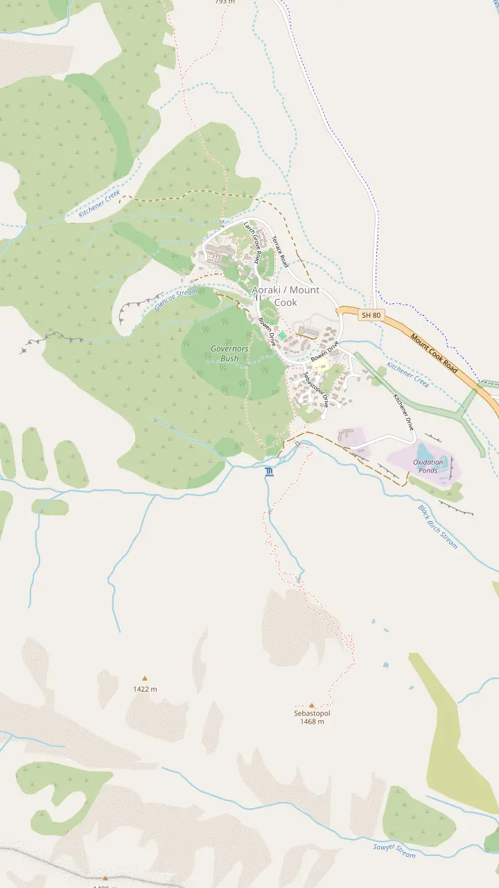
Free to enter and open daily from 8:30 am, with a large window that frames the mountain.
Google MapsThe hotel holds the Alpine Restaurant, the Panorama Room and the entrance to the Hillary Alpine Centre.
Google MapsA 30-minute walk from behind the Hermitage up to a lookout over the village.
Google MapsA 1.2 km loop through the trees to a lookout, sheltered on a poor-weather day.
Google MapsA steep, stepped climb of 300 m to small tarns coloured by red pond weed.
Google Maps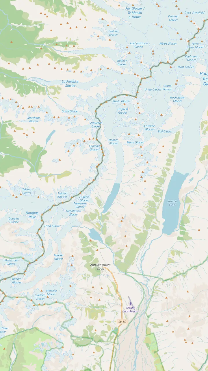
At 3,724 m, the highest peak in New Zealand, an ancestor sacred to Ngai Tahu.
Google MapsA 33-bunk alpine hut, the base for the guided route up the Linda Glacier.
Google MapsSeen from the Kea Point deck and the Hooker Valley lookouts.
Google MapsThe glacier at the head of the Hooker Valley, which feeds Hooker Lake.
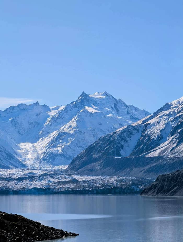
Google MapsThe lake at the end of the Tasman Glacier, the largest and longest glacier in New Zealand.
Google MapsOne of the five big valley glaciers that shaped the park.
Google Maps© OpenStreetMap contributors, map data
There is only one road into Aoraki/Mount Cook, and every plan for how to get to Mount Cook National Park ends on it. Here are the drive times, buses, fuel stops and winter rules.
Editorial team, mountcookdaytour.com · Updated November 8, 2026 · A 7 min read
The essentials
Every route to the mountain ends on the same road. As the Department of Conservation puts it, you turn off State Highway 8 onto State Highway 80, and the park lies where that road runs out.1 That road runs up the shore of Lake Pukaki and the valley beyond it, and stops at the village. Beyond the village there is no road into the mountains, so whether you drive, ride a bus or join a tour, you arrive the same way and leave the same way.
This matters for planning. There is no back road to escape a closure and no shortcut from the West Coast glaciers on the other side of the range. The village is tiny. Its public facilities, as DOC lists them, run to a day shelter (toilets, plus showers that take coins), the visitor centre, a petrol pump and a handful of places to eat and drink.4 For a supermarket and other services you need Twizel, 1 hour back down the road, or Tekapo, 1.5 hour away.5
Inside the park, the main walks start from short side roads. Hooker Valley Road leads to White Horse Hill car park, and Tasman Valley Road to the car park for the glacier view walk; DOC gives White Horse Hill as 5 min from the village.6 Both side roads leave the highway just outside the village, so a stay or a tour reaches them quickly.
Every way in
| Way in | From | Time | Good for |
|---|---|---|---|
| Car | Christchurch | 4.5 hours1 | Freedom, early starts |
| Car | Queenstown | 3.5 hours1 | The Lindis Pass road |
| InterCity bus | Tekapo | 1 hour and 20 minutes2 | A night at the village |
| InterCity bus home | Mt Cook to Christchurch | 4 hours and 55 minutes12 | The return leg |
| Tekapo shuttle day | Lake Tekapo | 8.5 hours | Walkers at Tekapo |
| Coach day | Christchurch | 13 hours | A return day with pickup |
| Charter flight | A Mackenzie airfield | By arrangement | Scenic flights13 |
Road times are without stops; bus times are the operator's approximate figures.1,2
From Christchurch, DOC allows 4.5 hours for the drive.1 The Mackenzie tourism body breaks the same trip down: about three hours to Lake Tekapo, then one hour further to the mountain, with more time needed if you stop in Fairlie and Geraldine.7 Tourism New Zealand puts Lake Tekapo 3h from Christchurch and 1h 15m from Aoraki / Mount Cook.9
From Queenstown, DOC gives 3.5 hours.1 On the national tourism site, Twizel sits 2 hours 20 mins from Queenstown and Omarama 2 hours from Queenstown and 1 hour from Aoraki Mount Cook.10,11 The figures differ a little between sources, which is normal for mountain roads; treat them as driving time without stops, and add generously for photos.
Within the basin, the regional figures are handy: Fairlie to Lake Tekapo 30 minutes, Lake Tekapo to Twizel 45 minutes, Tekapo to the village in 1 hour 15 minutes, and the village back down to Twizel in 45 minutes.8 From Wānaka, you join the Queenstown road and come through the Lindis Pass, so plan it like the Queenstown drive with a little less at the start.
Is the road to Mount Cook open today? Check before every trip: snow can close State Highway 80, and DOC asks every visitor to check highway conditions before travelling.3 Use the official New Zealand transport agency highway conditions page on the morning you leave, not the night before. Conditions in the basin can change faster than a forecast suggests.
Winter is when closures are most likely. Between June and September, DOC cautions, snowfall can restrict the way in.15 The regional tourism site adds its own warning: winter roads can carry snow and ice, and the high country throws in climbs, descents and tight bends.17 Carry warm clothing, food and water in the car, and never assume a road that was clear yesterday will be clear today.
Weather can also turn quickly in other seasons. DOC notes very fast changes in the region, with strong wind, heavy rain and snow possible at any time of year.18 A tour handles these calls for you: our coach day operates in all weather, and the guide decides how to adapt the day. Driving yourself, the decision is yours, so build a spare day into your plans if you can.
Choose your way in
Say how you are travelling and see the simplest way to the mountain.
If I have a car and a free day
Drive State Highway 80
DOC gives 4.5 hours from Christchurch and 3.5 hours from Queenstown.1
If I am staying at Lake Tekapo
Take the Tekapo shuttle
An 8.5-hour guided day with 4 hours on the Hooker Valley Track.
If I want a night at the village
Take the InterCity bus
About 1 hour and 20 minutes from Tekapo to the Hermitage.2,14
If I am travelling in winter
Check the road first
State Highway 80 can shut for snow, and June to September brings the most limits on access.3,15
If Someone else should do the driving
Join a guided day
Our coach day from Christchurch runs 13 hours with hotel pickup.
Three ways to arrive
Flexible
State Highway 80
For a night there
Tekapo to the village
Our pick here
Guided day from the lake
You can reach the village by scheduled bus. InterCity runs a bus from Tekapo to Aoraki / Mt Cook Village in about 1 hour and 20 minutes, leaving from the car park beside the Dark Sky building in Tekapo and arriving at the Aoraki Lobby of the Hermitage Hotel.2,14 It may run as a codeshare with GreatSights New Zealand.71
To get to Tekapo first, InterCity runs daily buses from Christchurch, a ride of about 3 hours and 25 minutes, and from Queenstown, with fares from NZD 1 plus a booking fee.72,73 The regional tourism body also lists the Tekapo Bus, a daily scheduled service between Lake Tekapo, Fairlie and Christchurch International Airport.74 Check the timetables carefully, as connections are not always on the same day.
Going home, InterCity runs daily buses from Mt Cook to Christchurch, about 4 hours and 55 minutes.12 Buses make sense if you plan at least a night at the village. As a day trip they leave little time at the mountain, and a guided day or a one-way tour usually works better. A sensible pattern is a guided ride in, a night or more at the village for the walks, and the bus home on a morning that suits you.
Driving from Christchurch
First stage
About three hours, longer with stops in Geraldine and Fairlie.7
Fairlie
Fairlie to Lake Tekapo takes 30 minutes.8
Lake Tekapo
The last run from the lake to the village is 1 hour 15 minutes.8
State Highway 80
The park road leaves State Highway 8 and ends at the village.1
Last minutes
White Horse Hill car park is 5 min from the village.6
If you are staying at Lake Tekapo, a Mount Cook tour from Tekapo is the easiest day out. The shuttle day we feature on this page runs 8.5 hours from the Four Square car park in Tekapo, with a live English guide; check-in is 10 minutes before departure. It starts from $99 and holds 406 reviews averaging 4.8.
Its day is built for walkers: 50 minutes to Peters Lookout for a 10-minute stop, the Tasman Glacier Viewpoint walk for 45 minutes, 4 hours on the Hooker Valley Track, 30 minutes in the village and a stop at an alpine salmon shop on the way back. You bring lunch; water and snacks are provided. The listing warns the return may run about 30 minutes late in summer traffic.
A shorter option from Tekapo runs 5 hours with 2.5 hours at Mount Cook and pickup at the Dark Sky Project or a lakeside resort. It rates lower, 4.2 from 54 reviews. For keen walkers the longer shuttle day gives better value; for a quick look with less walking, the short trip does the job. Either way, the drive from the lake is short enough that you see the mountain in the best of the day, not at the end of a long haul.
Video
Dashcam Roadshow on YouTube · Playback files load only once you tap play.
Distances on maps may appear shorter than they actually are due to narrower roads and often hilly terrain.
Before you set off
Flying in is possible, but not on a scheduled airline. The closest international airports are Christchurch and Queenstown, and charter flights serve 4 Mackenzie airports: Glentanner, Aoraki/Mount Cook, Lake Pukaki at Twizel, and Lake Tekapo.13 In practice, flying in means a charter or a scenic flight package, not a seat you book like a bus ticket.
The simplest flying option is a day from Queenstown with a scenic flight to Mount Cook village and about 5 hours of free time there. Flights depend on the weather and need minimum numbers. From the village you can also take scenic flights over the glaciers; our sister guide to the Tasman Glacier compares those.
Whatever you fly, keep a road plan in reserve. The weather that makes the mountains spectacular is also what grounds small aircraft, and DOC warns of very fast changes in wind, rain and snow at any time of year.18 A flight that waits for clear skies can wait a long time, while the road, snow aside, keeps running. Schedule flying for the first days you are in the region; a grounded morning then still has a fallback.
You cannot drive up the mountain itself. The road ends at the village, at the end of State Highway 80.1 From there, walking tracks lead into the valleys, and the summit at 3,724 m is a serious mountaineering objective, not a walk.75 What you can do by car is reach the trailheads in minutes, park, and be walking toward the ice almost at once, which is the great luxury of sleeping in the village or nearby.
Parking is where drivers get caught out. DOC charges at White Horse Hill: NZD 2.50 per half hour or NZD 25 a day, with the first 20 minutes free.76 Payment is by card only, with no cash accepted.68 DOC also warns of limited spaces there from November to March between 10 am and 4 pm.69 The Tasman Valley car park is free.70
Fuel up before the park. The Mackenzie region has stations at Fairlie, Lake Tekapo and Twizel, and the village has a self-service pump that takes credit cards only.67 To drive at all you need a current overseas licence or an international driving permit.66 And take the regional warning to heart: on these narrow, hilly roads a map makes every leg look quicker than it is, so leave a margin.16
FAQ
That is the Department of Conservation figure for the drive to the park.1
The Department of Conservation estimate for the Queenstown run to the park is 3.5 hours.1
InterCity runs Tekapo to Mt Cook Village in about 1 hour and 20 minutes.2
Snow can close State Highway 80; DOC asks visitors to check highway conditions first.3
The village has a self-service petrol pump that takes credit cards only.67
That is the regional tourism body's figure for the lake-to-village drive.8
Charter flights serve 4 Mackenzie airports, including Aoraki/Mount Cook.13
Sources
Further reading
Planning a day out to Aoraki? A real person replies here.